Category Archives: GPS Data

End of Life for the Halfmile Pacific Crest Trail App

Halfmile Pacific Crest Trail app

Halfmile Pacific Crest Trail app

We are sad to announce the end of life for the Halfmile Pacific Crest Trail app effective March 15, 2019. We no longer have the resources to continue updating the app.

The Halfmile PCT app was one of the first PCT navigation apps when it was created in 2012 and has been downloaded by hikers more than 37,000 times. Unfortunately we have not been able to update the Halfmile PCT app since 2015.

Hikers will be able to download the Halfmile PCT App from the iPhone App Store or Google Play until March 15th. If the app is installed before then it will continue to work on your Smartphone. Keep in mind the Halfmile app has not been updated since 2015. It does not include data on the 2017 reroute in the Sierra Buttes (north of mile 1203 mileages will be off by 2.5 miles), some resupply information is no longer accurate, and at some point in the future (probably years from now) an update to your smart phone operating system may break the Halfmile app.

FAQ’s

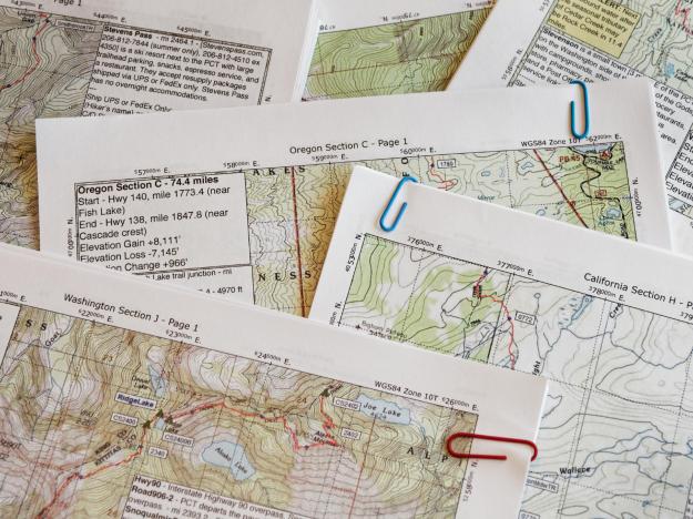
What about Halfmile’s PCT maps?
Halfmile PCT maps have been updated for the 2019 hiking season and are available for download now.

What about Halfmile’s PCT GPS data?
Halfmile’s PCT GPS data will continue to be regularly updated.

What PCT navigation app can I use instead of the Halfmile app?
Gaia GPS is our favorite GPS navigation app.
Pros: Powerful GPS navigation tool. Halfmile’s PCT GPS data is easily loaded into Gaia for offline use. Maps other than the PCT can be downloaded so you can navigate around large fire closures. Supports waypoint navigation for difficult situations (across miles of snow, for example).
Cons: Learning curve, especially for hikers unfamiliar with GPS navigation.

The Guthook Guides app is widely used by PCT thru-hikers. Guthook is more of a GPS-enabled trail guide but excellent for PCT hikers in most situations.
Pros: Easy downloading of trail data for offline use. Widely used by other PCT hikers. Useful information about town resources (accommodations, resupply, post offices, etc). Waypoint comments by other hikers can be very useful.
Cons: Gaia is more useful than Guthook in difficult navigation situations such as large areas of heavy snow or long reroutes around large fire closures. Guthook base maps show only a narrow area along the PCT.

Backcountry Navigator is another GPS navigation app popular with some Android smartphone users.

Philip at SectionHiker.com has a post comparing GPS-Enabled Trail Guide Apps vs General Purpose GPS Navigation Apps.

Gaia GPS reviews have been posted by PMags and Adventure Alan.

Notice to Hikers: Halfmile Smartphone Apps Will Not Be Updated For 2018

The Halfmile smartphone app showing Pacific Crest Trail information near Warner Springs, CA.

The Halfmile smartphone app showing Pacific Crest Trail information near Warner Springs, CA.

We have come to the unfortunate conclusion that the Halfmile Android and iPhone Apps will not be updated for the 2018 hiking season due to other commitments and lack of available time.

Halfmile Pacific Crest Trail Maps, GPS files, Google Earth Files, and Trail Notes have all been updated for 2018. Only the Smartphone Apps have not been updated. If hikers need to convert between 2015 mileages (still used by the Halfmile App) and 2018 mileages, a version of the Halfmile Trail Notes has been published that includes both 2015 and 2018 mileages.

What does this mean for 2018 Pacific Crest Trail hikers? Halfmile Smartphone Apps will continue to work, but hikers might notice:

  • Resupply and other information contained in the Halfmile Smartphone Apps may not be current and should be verified from other sources such as a phone call to the various locations or Halfmile Trail Notes.
  • The Sierra Buttes Reroute (starting near mile 1204), that was completed in the fall of 2017, is not included in the Halfmile app. This new route replaced about 4.4 miles of old trail with 6.9 miles of new trail.
  • Because the PCT is now 2.5 miles longer than the previous year, mileages in the Halfmile app north of about mile 1210 will be off by 2.5 miles.

  • Hikers needing an app that uses the latest Halfmile PCT data could consider Gaia GPS or other apps that import GPX files. It’s easy to import Halfmile data into these apps using the data at this web page.

    Halfmile data can be imported into the Gaia GPS or other smartphone apps.

    Halfmile data can be imported into the Gaia GPS or other smartphone apps.

    2018 Pacific Crest Trail Map Updates

    Pacific Crest Trail Maps, updated for 2018.

    Halfmile’s Pacific Crest Trail maps have been updated for the 2018 hiking season.

    The biggest changes for 2018 are in California Section M (in Northern California), where after several years of work, approximately 4.4 miles of old trail was replaced with 6.9 miles of new trail. This reroute increased the length of the PCT by 2.5 miles. The new route and mileages are shown on the new 2018 maps. Because of this, the Pacific Crest Trail is now 2.5 miles longer and the mileages north of PCT mile 1203 have increased by 2.5 miles. Mileage south of mile 1203 remain unchanged.

    Elevation profile pages have been improved for 2018 by squeezing more waypoints on the elevation charts.

    Halfmile’s Trail Notes have been updated for 2018 with the new mileage and now are available online.

    2018 Halfmile GPS and Google Earth files will be available in the next few days.

    The free Halfmile smartphone app will hopefully be updated in about a month. The app should auto update on your phone when a new version is available.

    Check the Halfmile What’s New Page and the Corrections and Updates Page for the latest information and corrections.

    -Halfmile


    Pacific Crest Trail Weather Forecasts

    Rain along the Pacific Crest Trail in Southern Oregon.

    Rain along the Pacific Crest Trail in Southern Oregon (photo by Halfmile).

    Several hikers have asked about Pacific Crest Trail weather forecasts. We use the National Weather Service (NWS) point forecasts from Weather.gov. These point forecasts are for a 2.5km grid and using Halfmile Project data makes it easy to find the forecast for a specific location along the PCT. Point forecasts are for the elevation of the PCT which are often thousands of feet above nearby towns.

    Links to NWS weather point forecast along the PCT:

    Mile 0 — Southern Terminus of the PCT — Desktop Link | Mobile Link
    Mile 42 — Mount Laguna — Desktop Link | Mobile Link
    Mile 110 — Warner Springs — Desktop Link | Mobile Link
    Mile 179 — Saddle Junction (near Idyllwild) — Desktop Link | Mobile Link
    Mile 210 — Highway 10 (near Cabazon) — Desktop Link | Mobile Link
    Mile 275 — Van Dusen Canyon Road (near Big Bear) — Desktop Link | Mobile Link
    Mile 374 — Vincent Gap (near Wrightwood) — Desktop Link | Mobile Link
    Mile 454 — Agua Dulce — Desktop Link | Mobile Link
    Mile 565 — Tehachapi Pass — Desktop Link | Mobile Link
    Mile 652 — Walker Pass – Desktop Link | Mobile Link
    Mile 704 — Kennedy Meadows — Desktop Link | Mobile Link
    Mile 767 — Mount Whitney — Desktop Link | Mobile Link
    Mile 839 — Muir Pass — Desktop Link | Mobile Link
    Mile 943 — Tuolumne Meadows — Desktop Link | Mobile Link
    Mile 1017 — Sonora Pass — Desktop Link | Mobile Link
    Mile 1153 — Highway 40 near Donner Pass — Desktop Link | Mobile Link
    Mile 1265 — Bucks Summit — Desktop Link | Mobile Link
    Mile 1388 — Hat Creek Rim — Desktop Link | Mobile Link
    Mile 1507 — Castle Crags — Desktop Link | Mobile Link
    Mile 1597 — Etna Summit — Desktop Link | Mobile Link
    Mile 1716 — Callahans Lodge (near Ashland, OR) — Desktop Link | Mobile Link
    Mile 1836 — Crater Lake Rim — Desktop Link | Mobile Link
    Mile 1905 — Willamette Pass — Desktop Link | Mobile Link
    Mile 1998 — Santiam Pass — Desktop Link | Mobile Link
    Mile 2095 — Timberline Lodge — Desktop Link | Mobile Link
    Mile 2211 — Indian Heaven Wilderness — Desktop Link | Mobile Link
    Mile 2292 — White Pass — Desktop Link | Mobile Link
    Miel 2391 — Snoqualmie Pass — Desktop Link | Mobile Link
    Mile 2461 — Stevens Pass — Desktop Link | Mobile Link
    Mile 2518 — Mica Lake — Desktop Link | Mobile Link
    Mile 2630 — Harts Pass — Desktop Link | Mobile Link

    Note: The “current conditions” for these point forecast are from the nearest weather reporting station which could be many miles away from the actual forecast area and may not be as useful as the actual forecast.